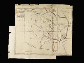
Carte territoriale de la commune de Salles-la-Source
- 1
- Item
- sans date
14 results with digital objects Show results with digital objects
Carte territoriale de la commune de Salles-la-Source
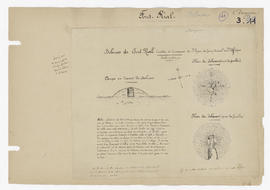
Coupe et plans des dolments de Font-Rial
Document distribué distribué à la réunion de Clermont Ferrand de l'Association française pour l'avancement des sciences en 1876.
Plans et coupes dessinés par un surveillant du chemin de fer fouillant pour Mr Lalanne de Bordeaux.
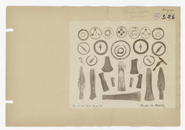
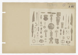
Photographies d'objets divers (fibules, figures...) - musée de Rodez
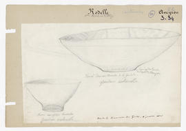
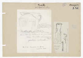
Dessin de deux vases trouvés dans le tumulus de la Goudalie
Les deux vases ont été trouvés dans le tumulus de la Goudalie. Ils sont représentés en taille réelle.
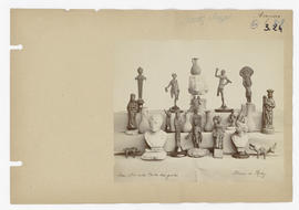
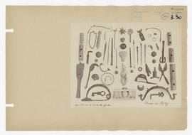
Photographie d'un groupe d'objets bronze et statues - musée de Rodez
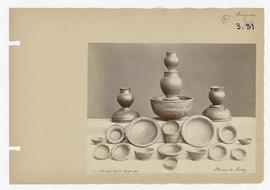
Photographies de vases - musée de Rodez
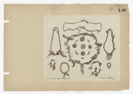
Photographies de fibules, de boucles de ceinture - musée de Rodez
Dessin de vase provenant du tumulus de la Goudalie et dessin de hache et deux fibules
Deux dessins d'objets trouvés au tumulus de la Goudalie.
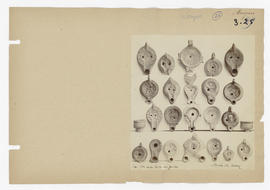
Photographie d'un groupe de lampes - musée de Rodez
Photographies d'objets divers - musée de Rodez
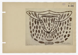
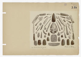
Photographies de silex, bracelets et colliers - musée de Rodez
Ruines d’un aqueduc romain (élévation restaurée)