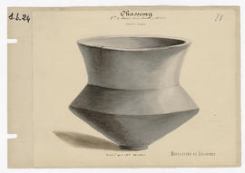
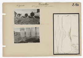
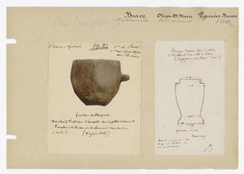
Sépultures de Chassemy - grand vase
- 7
- Item
- sans date
903 results with digital objects Show results with digital objects
Sépultures de Chassemy - grand vase
Sépultures de Chassemy - grand vase à motifs géométriques
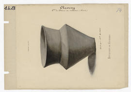
Sépultures de Chassemy - vase rayé et ébréché
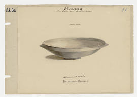
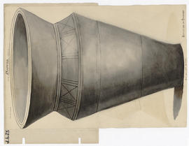
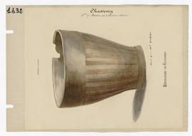
Sépultures de Chassemy - vasque à rebords
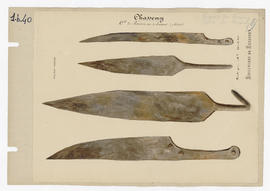
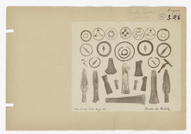
Sépultures de Chassemy - objets tranchants
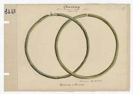
Sépultures de Chassemy - bracelets
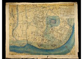
Carte présentant l'implantation des découvertes d'époque gallo-romaine dans la ville de Vichy, dressée par Le Faure, architecte de l'empereur à Vichy en 1868.
Hache de bronze trouvée à Liernolles, collection du Dr. Bailleau
Dessin de Bertrand de Moulins avec la mention d'une lettre du 10 mars 1869.
Commission de Topographie des Gaules
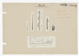
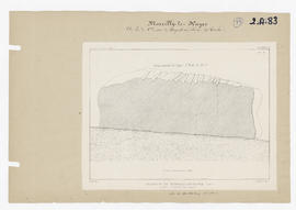
Polissoir de Marcilly-le-Hayer - coupe longitudinale
Planche sortie des Mémoires de la Société académique de l'Aube, tome XXXI.
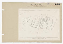
Polissoir de Marcilly-le-Hayer - vue en dessus
Planche sortie des Mémoires de la Société académique de l'Aube, tome XXXI.
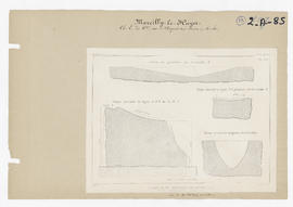
Polissoir de Marcilly-le-Hayer - coupe transversale et détails
Planche sortie des Mémoires de la Société académique de l'Aube, tome XXXI.
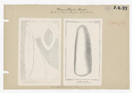
Hache polie trouvée dans la Seine
Planches sorties des Mémoires de la Société académique de l'Aube, tome XXXI.
Commission de Topographie des Gaules
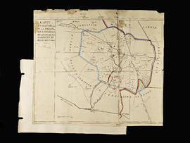
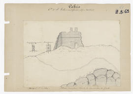
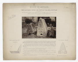
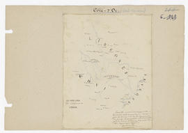
Carte territoriale de la commune de Salles-la-Source
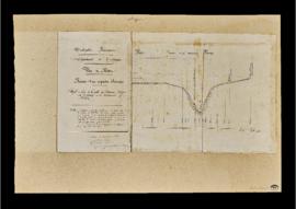
Ruines d’un aqueduc romain (profil en long)
Dessin d'une hache en bronze et d'une pierre taillée
Commission de Topographie des Gaules
Anneau en bronze – Tombes d'Odratzheim et Monument funèbre Gallo-Romain
Deux dessins : anneau en bronze grandeur nature (tombes d'Odratzheim) et monument funèbre gallo-romain à Le Hergott, à l'extrémité ouest de la forêt de Greiffenstein, près de Saverne.
Renvoi à des notices de De Morlet.
Commission de Topographie des Gaules
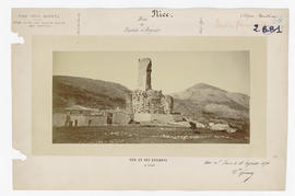
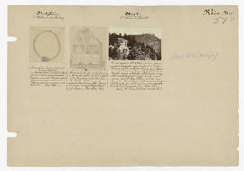
Musée de Saverne – Tombes gallo-romaines trouvées sur les sommités des Vosges entre Saverne et Dabo
Extrait d'une notice du colonel de Morlet commentant la photographie des pierres conservées au musée de Saverne.
Commission de Topographie des Gaules
Inventaire archéologique des Bouches-du-Rhône

Carte comparative de l'embouchure du Rhône en 1841 et 1872
Carte dressée par A. Germain, ingénieur hydrographe, septembre 1872. Publiée dans le Bulletin de la Société de géographie en novembre 1873. Tampon de l'établissement de gravure Erhard, à Paris.
Lettre adressée à Monsieur Saulcy, président de la CTG
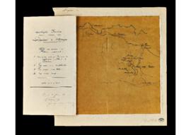
Plan de la Côte-d'Or sous le proconsulat de César
"Pour être annexé au rapport du 20 mars 1861 demandé ou soussigné par la Commission de la topographie des Gaules. Le correspondant du ministère pour les travaux historiques (... illisible) à la cour impériale de Dijon."
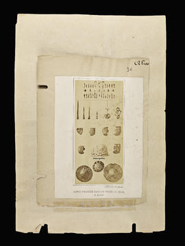
Armes trouvées dans les fossés de César à Alise